
Fall is upon us, and that means it’s the best time to take those road trips. Wisconsin has quite a few of these awesome road trips, so I’m going to try and publish one or two per year. October is right around the corner, and I highly suggest you spend at least ONE day of October doing a road trip to see the state and colors. Why not consider doing the Kettle Moraine Scenic Drive this year? I’m going to have to recall this trip out of my memory as best I can, but I think we’ll be fine. I also plan on doing this again, so I’ll have some refreshers when that happens. In the meantime though, this was such an awesome drive I can’t NOT make a post about it, despite taking the trip before I had the idea to do the blog. This drive had everything I love in a roadtrip and more… backroads aplenty, a quick brewery break, the perfect road-trip playlist, several stops to get out and stretch the legs in some very convenient nature-packed areas, and ridiculous fall foliage. Fall colors seem to be hit or miss since they only last for such a brief time, but man did we hit the lottery with when we went.

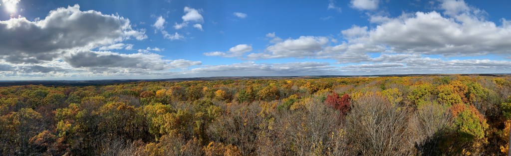
When an outsider thinks of WI, they might think of a flyover state, but for us locals, it’s more than that. Wisconsin to me is gorgeous fall colors on a perfect fall day. You know, not too hot, not too cold. Sweatshirt/hoodie temps, cloudy sky to really make those tree colors pop, and of course that smell… dead/dying leaves, someones brush fire off in the distance, and that unmistakable plant matter fragrance. Since I live in Sun Prairie, I decided to start this trip at the northern terminus, ending at its southern point so the drive home would be less. Good idea if you’re making it a day-trip… the amount of driving can become a lot by the end of the day. Also, the northern half was the better half in my opinion, so we got to savor more of that part while cruising through the southern part. The northern point begins just NW of Elkhart Lake, right on Sheboygan Lake (not near the actual city Sheboygan). On the drive to get to the starting point, you’re crossing various ridges and hills of the Kettle Moraine (info on that below), and this part of the drive is just as good as the actual KMSD. Upon our arrival at the “start”, we saw Sheboygan Lake Park off to our right, and stopped for a quick bathroom break and to stretch our legs. An overlook tower on the property revealed breathtaking views of the lake, the river that feeds it, and the overall surrounding wetlands (Sheboygan Marsh Wildlife Area). A very great way to start the trip. After 30 minutes of walking around the park we got back in the car and decided to start.
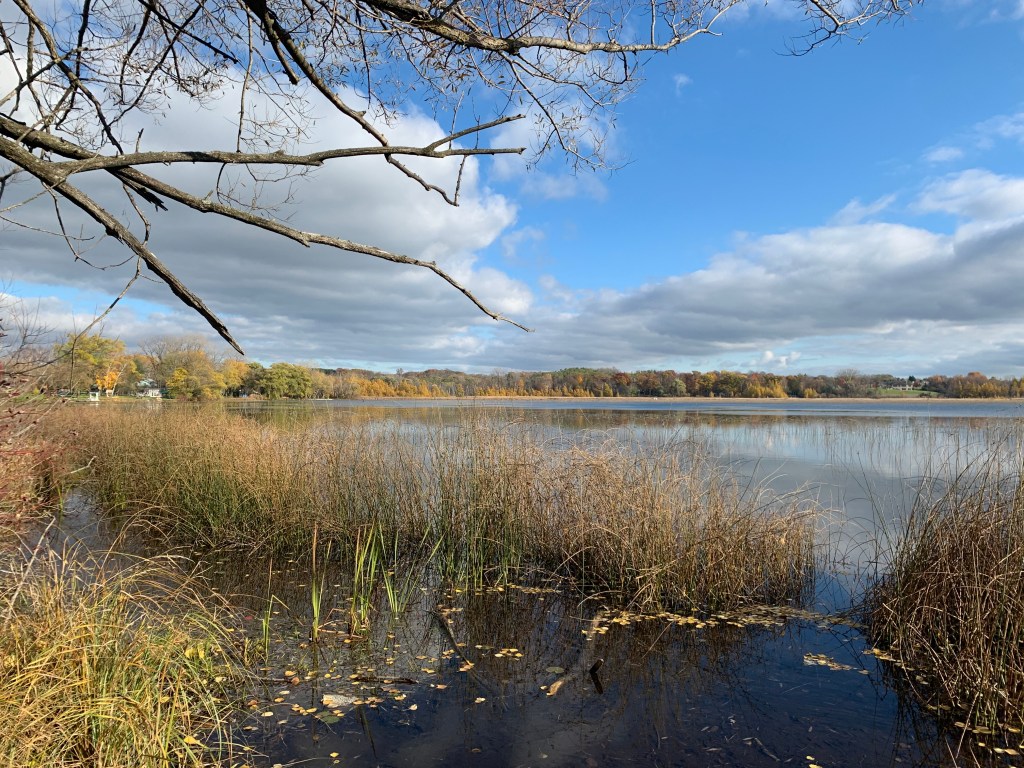
We didn’t make it very far before our first break, although for a good reason… Switch Gear Brewing Company!! After a quick flight and an appetizer, we got right back to the drive. From Switch Gear, the roads wound through several small towns (always a favorite of mine) and weaved in and out of the Northern Unit of the Kettle Moraine State Forest. We got out for another quick break at Parnell Tower. You do need a state park pass to get out here, but I always have one. The views from the tower are again great. I honestly don’t think you can beat a good overlook tower in Wisconsin in fall. In fact, after continuing the drive, our next stop wasn’t until the Pike Lake Tower, part of the Pike Lake Unit of the Kettle Moraine State Forest. Farther down the line, we ended up at a what seemed like a lake in the middle of nowhere (in reality it’s just north of West Bend, but you wouldn’t know it by looking around), Smith Lake. Another quick break to explore the lake and shore for a bit. We didn’t see a single person, and didn’t hear a single car drive by the entire time. To say it was peaceful would be an understatement.
Once you enter Waukesha County, things begin to change. You’re out of the forest (for now) but you now start to drive through more farm fields. The brown and gold of wheat and harvested corn is such a great contrast to the bright red, orange, and yellows of the trees. To me, that makes for very pretty landscapes. The route takes you through quite a few small towns in between dozens of lakes. The winding and weaving through the lakes doesn’t really feel like you’re in Wisconsin. At this point you’re a little more than halfway through the drive. It was late afternoon, and we were starting to fade. There probably were a few nice spots to stop and explore for a bit, but we were starting to get hungry and tired, and so kept driving. Once we were past Delafield, the route seemed to fly, and before we knew it we were in Walworth County, where it ends. The ending did get confusing too, due to poorly marked signs, and we might have gotten lost near Whitewater Lake, but that’s half the fun! We did stop at the dam between Whitewater and Rice Lakes, for another stretch and some pictures. Being in Whitewater, we debated between the breweries in Whitewater, or Lake Mills, which was closer to home. In the end we decided to head over to Sunshine Brewing Company in Lake Mills for some tacos and beer. A long, but successful day.
Alright, I’m going to nerd here for a quick second… I’m a science teacher, and I love glaciers. I think our states glacial history is so fascinating, and so many of the cool and unique things our state has to offer we can thank glaciers for. Seriously, think about it… The Dells, Lake Superior and Lake Michigan, by extension the Driftless Region, even the flat central sands. The KMSD is also one of these features. First of all, a kettle is a depression in the ground caused by a glacier, and it’s usually filled with water, aka a lake. So all these lakes in the area were created by glaciers. A moraine is the edge of a glacier, either the sides of an alpine glacier (and/or the end), or the edge of a continental glacier, in Wisconsin’s case. So during our last glaciation, which ended approximately 10,000 years ago, one of the lobes of the glaciers ended (at one point… the glaciers advanced and retreated many times, so this is just one of them) at this point before retreating. So, the Kettle Moraine area is defined by these many kettle lakes and moraine hills and ridges, among other glacial landforms (drumlins, eskers, kames, outwash plains, etc.), and thus how it was named.

Wrapping this post up, I will be doing this drive again… I love road trips and this is one of my favorites. I think we will most likely go south to north the next time, although I’m fairly confident we chose the best direction this time around, but you never know until you try it. I also think that although a day is all you really need, you do need a FULL day, if you want to actually get out and explore it. Driving from Sun Prairie up to Elkhart Lake, then down the drive to Whitewater, and THEN to Lake Mills, until FINALLY coming back home, makes for a very long day. I think we will stop at a motel or hotel in Elkhart Lake this next time, so we get the most out of the trip. If you’ve taken this drive before and I left something out, let me know about it!

