As long as I can remember I’ve wanted to know ‘why’. I look at the natural world around me and I am so curious as to how it works. Why do some of the cleanest and purest lakes up north look black? Why are those overly large rodents (beavers) so important in benefitting the environment? Why is the central part of the state so sandy but the northern parts are clay and silt? Why is there a super random ridge stretching from Fond du Lac to the tip of Door County? I got hooked on understanding these aspects of nature in high school and have been curious ever since. I just want to know how the world works. My quest for never-ending knowledge led me to become a science teacher, but it also got me to start this blog. I want to share that knowledge with everyone else. When I visit some place new, I want to learn from it. I want to understand it. And if I have that knowledge I have a greater appreciation for it. Most people love going to Door County for the small, picturesque towns and window shopping. I love going to Door County to see the extremely unique landscapes, interesting topography, and natural wonders it provides. Most people love going to a state park for the scenery, maybe some fresh air, maybe to get some exercise, maybe a combination. When I go to a state park though, I want to know why it looks the way it does. Each park is so different than the last, and I want to know as much about it as I can. Some of our most unassuming parks often have the coolest backstories. Wyalusing is no different.
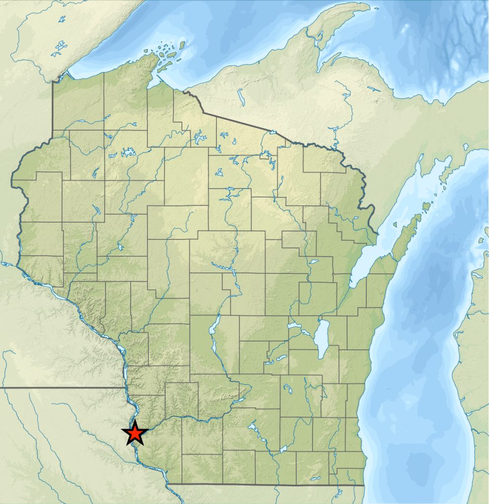
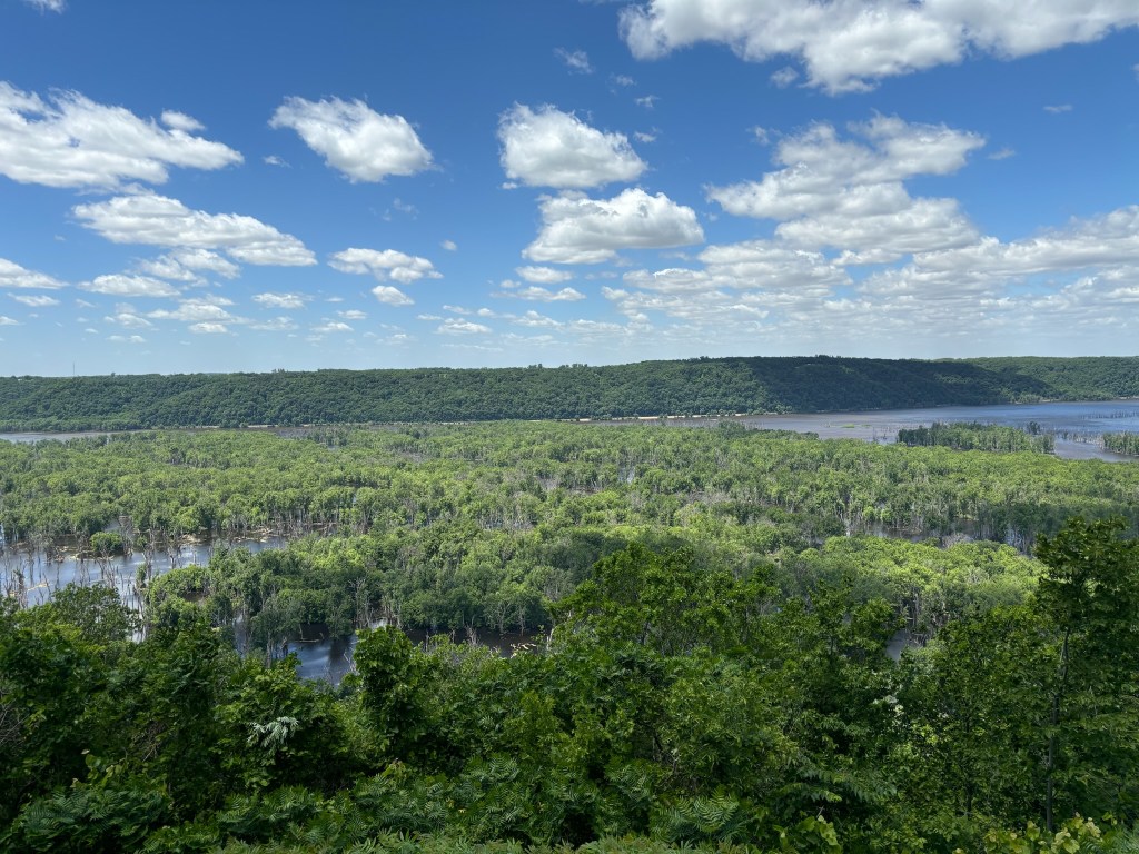
Wyalusing State Park is located in southwestern Grant County, just south of Prairie du Chien. It is the second-most southwesterly state park in WI, with the much smaller Nelson Dewey State Park taking those honors. Established in 1917, it is Wisconsin’s fourth state park, making it one of the oldest. Originally named Nelson Dewey State Park, in 1937 it was changed to its current name, and Wyalusing means “home of the warrior” in the Lanape (Munsee-Delaware tribe) language. In our previous post, we discussed that Wyalusing boasts several unique features each deserving of state park status on their own, but combined they make for a truly unique state park. An abundance of effigy mounds, its location at the confluence of the Wisconsin and Mississippi Rivers, classic driftless topography, and several caves unique to southwest Wisconsin’s rare karst topography all combine to make Wyalusing a must visit.
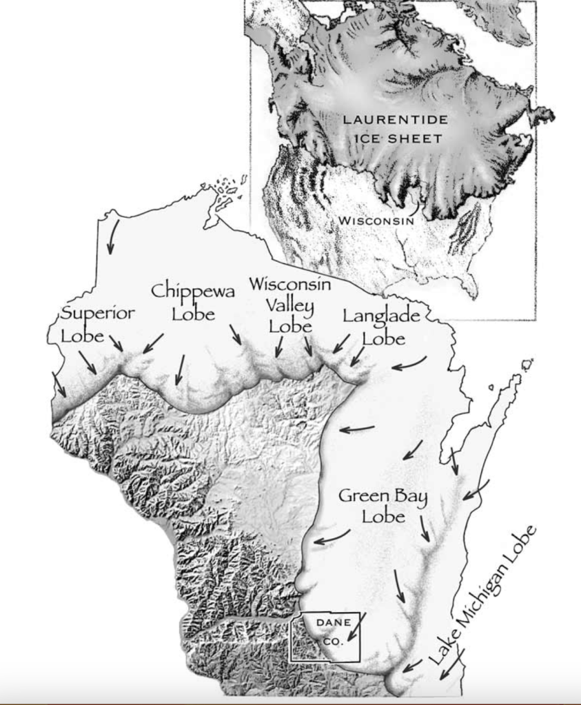
Geologically speaking, Wyalusing’s concentration of dolomite plays a large role in the landscape. Recall that the southwestern portion of our state is called the driftless region due to being relatively untouched by the last three glacial events. Also, I realize I just said “recall” as if I’ve done a post on this when in reality I’ve only actually mentioned it a handful of times and probably didn’t even explain that well. So, now you know. And a post on the driftless WILL come at some point, I promise. In the meantime, just look at this picture below and understand that Wisconsin got most of it’s looks due to glaciers, or in this case, lack thereof.
Anyways, this dolomite is important to Wyalusing for several reasons. Since Wyalusing was untouched by glaciers, erosion via wind and rain are really the only two ways to affect the landscape here, and the dolomite is much thicker than the rest of the state since rain and wind are far weaker than the mighty strength of the glaciers. Since the dolomite in Wyalusing is soluble (able to dissolve in water), that leads to karst topography. Karst topography leads to springs, caves, and sinkholes. Wyalusing has several caves due to this karst/dolomite combination, and although not as spectacular as the caves you might see on National Geographic, they are still a cool sight to behold.

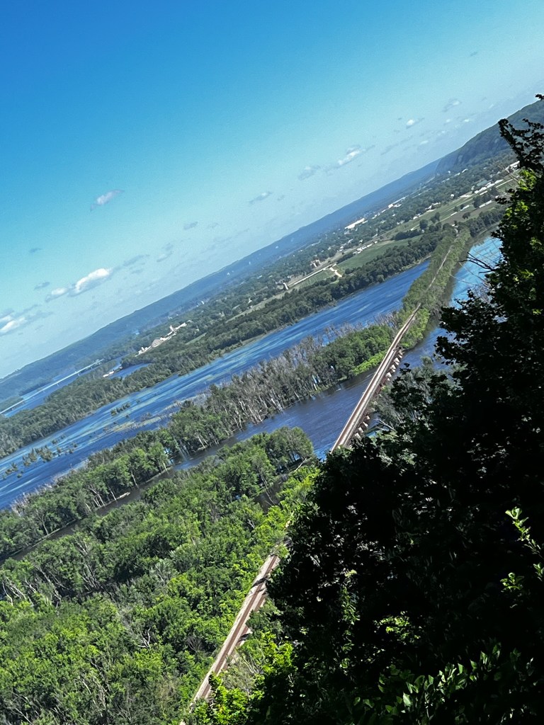
Another very unique aspect to Wyalusing is the way the Wisconsin River ends. If you’ve ever had an ecology, geography, or geomorphology (quick aside here: geomorphology is by far the coolest subject in the world) class, you’d know that the farther away from a rivers source, the bigger the river tends to get, and the wider the river bed tends to be. This is because the longer it flows, the more tributaries are added to it. More water = bigger rivers, = more erosion = wider river beds, FOR THE MOST PART. Don’t come at me with the few exceptions on this planet… I’m making a generalization for educational purposes here. As a river gets to it’s end (mouth), you find the widest part of the river as it either empties into another river/body of water, and/or forms a delta. The Wisconsin River is one of those exceptions though. At its mouth in Prairie du Chien/Wyalusing, it is just half a mile wide. Much farther upstream it gets as wide as 4 miles in some parts. There are two possible reasons for this, and I subscribe to the idea that it is most likely a combination of the two.
Reason number 1 – Sandstone upstream, dolomite downstream. Sandstone is for the most part way easier for water to cut through than dolomite. Over the years this would indeed lead to a significant difference in river bed width. But that is most likely not the whole story.
Reason number 2 – Glaciers. BuT aNdY, yOu SaId It WaS pArT oF tHe DrIfTlEss (that’s how you type in absurd sarcasm btw). It was and is part of the driftless, but little known fact is that the driftless pretty much stops at the WI/MN border, for reasons that will be explained in the driftless region post, but there is some evidence that the glacier pretty much ended at this Wisconsin/Mississippi River confluence. Glaciers are fairly large, and there is also strong evidence to suggest that during this time period, the WI River flowed east at the current mouth, instead of its present-day west, due to the glacier. If this indeed the case, then the Wisconsin River would follow the typical pattern of gradually widening as it gets further away from its source, in this case the melting glacier at the confluence of the Wisconsin and Mississippi Rivers. If current evidence is to be correct, the Wisconsin River might have flowed this opposite direction for up to 2 million years vs the half a million that it might have flowed in its current direction. Of course as more evidence is collected we can change our view one way or the other, which is why I think it might be a combination of the two reasons above.
Before I ramble on too much, let’s wrap up with some history of the area. Evidence suggests humans moved into the area around 11 thousand years ago, after the glaciers had retreated far enough out of Wisconsin. Hopewell cultures followed them later, as shown by the numerous effigy mounds, a classic Hopewell culture tradition. Archaeologists believe up to 14 different tribes from that 11,000 years ago inhabited or regularly visited this area for trading purposes. The Winnebago and Ho-Chunk were two of the latest tribes to inhabit the area. After European settlement, there was a brief, failed attempt at mining, but as with most of Wisconsin, farming saw much better results.

Wyalusing has everything in a state park you can possibly want, and I hope you make it here one day. Great views, unique topography and geology, incredible ecology (a state natural area is actually within the parks boundaries – Wyalusing Hardwood Forest State Natural Area, which boasts four different forest types [wet mesic, mesic, dry mesic, and dry forest types all in a relatively small area]), rare wildlife, archeological sites, caves… the gems just don’t stop. All info for this post was obtained from my brain (a few things) and from “Wisconsin State Parks: Extraordinary Stories of Geology and Natural History” by Scott Spoolman (most things). In fact, if you enjoy geology, natural history, ecology, etc. of our state, this book is a MUST. And it contains way more info on Wyalusing (and the rest of the parks) than I provided here. Pick up a copy at your leisure and enjoy!
