
Sturgeon Bay has an extremely interesting and very rich history. One of the great things about this state is that Wisconsin not only has a fairly deep history, but it’s a varied history. In fact, I think probably the coolest thing about this state is that within it, we have our very own microcosm of the United States history at large. Think back to what you learned in school about the history of this country. Independence from the British, yes, but colonial history involves a general independence from European cultures. Wisconsin, despite not being part of that initial part of history, has plenty of European ties, especially French. The state is riddled with Native American history too (unfortunately the bad and the good, like the rest of the country). Lumber and farming are a large part of the economy of the early country, and those are, or were, two of the biggest industries in Wisconsin as well. Sturgeon Bay’s history is rife with the maritime industry, which mimics that of the east coast to a lesser degree also. Sturgeon Bay at one point even had an industry related to cutting out and shipping ice across the country. Its history is a patchwork of industries, but that is part of what makes the city so unique.

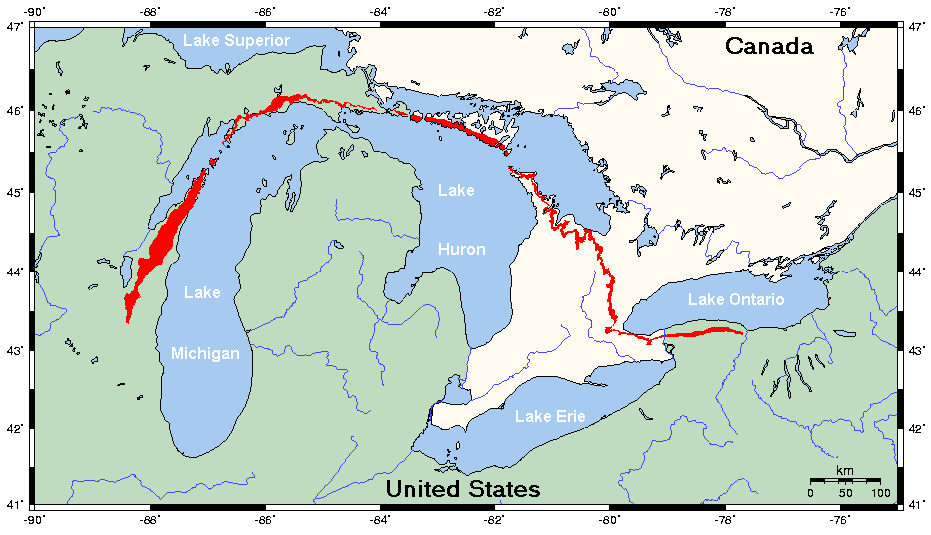
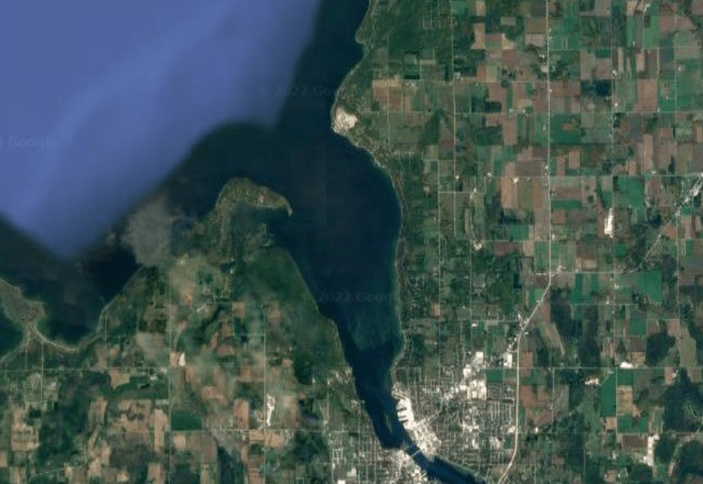
Sturgeon Bay is located just northeast of Green Bay and just southwest of the “main” part of Door County… essentially halfway between Green Bay and Gills Rock, the tip of peninsula. Even though Sturgeon Bay is about one third/one half into the peninsula itself, it prides itself on being the entrance to Door County, and it really is. Something seems to change when you enter Sturgeon Bay, and for most folks, continue on up further into the peninsula. Perhaps the canal makes it seem like you cross over into a whole different county when you pass over it (you’re not… it’s still Door County). Or maybe it’s that the landscape changes ever so slightly from farmland only to farmland and some forested areas with rocky outcrops, and plenty of orchards of course (Cherries every 15 miles). Or, most likely, it’s that when you’re entering Sturgeon Bay, regardless of whether you’re continuing on to some other Door County town, you’re on vacation and this is the moment it hits you… you’re free. Free from work obligations, free from the day to day mundanity of your Monday-through-Friday 9-5, and free from your boring suburb-riddled views on a daily basis. The Northwoods captures this feeling equally well, and for those with small kids, I’d imagine the Dells as well. Sturgeon Bay just feels like vacation. And its place in our great states history shouldn’t be overlooked due to this. You wouldn’t know it at first glance either, but places like Sturgeon Bay, Wisconsin Dells, and the cities of the Northwoods all have their places in history for being more than just vacation destinations.
Let’s go way back in time, shall we? WAYYYY back. Millions of years ago, Wisconsin was both nearer to the equator, and also under water. Sediments, mixed with shells of marine organisms, eventually compacted and cemented into layers of limestone, specifically dolomite, when the waters retreated and the North American Plate moved to its current location. Fast forward a bit, like a lot a lot, but not so much that we’re not still way back in time, and the body of water that is the bay of Green Bay, and Lake Michigan (all the great lakes really), were formed in the era of the glaciers, between 100,000 and 10,000 years ago. I’ll have a post specifically about the history of this state geologically at a later point, but for the purposes of Sturgeon Bay’s history, this is as brief as I’ll get with this aspect. Glaciers like the ones in the last ice age are clearly big and strong enough to carve out massive areas if the ground is soft enough. When they retreat, they tend to leave massive basins behind. When the glaciers melted and sea levels rose a bit, those basins filled in with water forming lakes. The areas that the great lakes occupy today certainly qualify in that regard. So… why the peninsula? How did that get spared? Well, it didn’t totally. Glaciers did carve over and through the peninsula. But unlike the rest of the region, the peninsula had a layer of very hard, very strong dolomite underneath. This dolomite proved to be very glacier resistant, so the layers above this hard rock were eroded by the glaciers, leaving this layer behind. This layer is known as the Niagara Escarpment. It is what’s called a cuesta (in geology/geography terms), which means it has a gentle slope on one side of the ridge, and a steep slope, or scarp, on the other side. In Door County, the western edge, the border between water and land, is marked by these stark cliffs, and the eastern edge is the side that gently rolls to a flatter area. And yes, its namesake comes from that famous waterfall in New York/Canada, and this chain of limestone (dolomite is a type of limestone) forms much of the upper basin of the great lakes in one big arch, extending from New York, all the way down to south of Fond du Lac.
So now that we know HOW the peninsula formed (I doubt anyone reading this either cares or didn’t already know this, but I wanted to write about it anyways :), let’s talk about it’s place in Wisconsin history. When the glaciers melted 10,000 years ago, the land opened back up for occupation by plants, animals, and humans. Native Americans obviously moved in first. The Ho-Chunk, Potawatomi, and Menominee, or their ancestors, were the first to inhabit the peninsula. In 1831 representatives of several, but not all tribes, were involved in the treaty of Washington, which ceded 2.5 million acres of land, mainly abutting Lake Michigan, to the United States Government, for a price of clothing and provisions totaling around $92,000. Chief Oshkosh, the primary Menominee Chief was not present (and neither were any representatives from the Oneida tribe whose land interests were effected as well), and so, as with most US Govt./Native American treaties, there was some controversy. But after the treaty was signed, the land was now open to future Wisconsinites to move in. There is some controversy (and by controversy I just mean I keep finding conflicting information so there isn’t any controversy, just poor research skills by your truly) as to who the first white people in Sturgeon Bay are, but most sources say Increase and Mary Claflin (yes… his name is Increase. No… I did not know that was a name either. Yes… it is extremely weird) were the first to move to the area now known as Sturgeon Bay. The couple is not only credited with being the first in Sturgeon Bay, but the first settlers in the entirety of Door County.

As Increase was a trapper, the Claflin’s moved about the peninsula, moving on from Sturgeon Bay and living in what is now Peninsula State Park, and ending up in Fish Creek towards the end of their lives. Oliver Perry Graham and his brothers are generally credited though with being the founders of Sturgeon Bay. They moved into the area in the 1850’s and established a saw mill. Because of them, the first name of the town was Graham. The name changed two more times, first to Otumba (the name of an Algonquin village in the area), then finally to Sturgeon Bay, the namesake of the body of water it is on. Its name is exactly why you’d think it’s called that, and that is because in the 1600’s the French called it the Bay of Sturgeons (in French of course), due to the abundance of sturgeon in the waters. Sadly, most of the sturgeon are gone, but the name remains. I do want to clarify something here, and that is that a few sources also have the name of Sturgeon Bay gifted not by the fish alone, but by the shape of the bay. I do not subscribe to that idea, for two reasons. One, I just don’t see the resemblance they are making, and two, are we really to believe that in the 1800’s they made that connection without ever having access to an aerial view of the bay or surrounding land? Sorry, I just don’t buy it.
Sturgeon Bay from the 1860’s to today has a history that is as varied as you can possibly imagine. Like, from this point on, it gets crazy. A teenager using their lingo kinda crazy. Fishing and logging were the first two industries in and around the town (this is reflective of Door County as a whole), but, like most of early United States, we overdid it. During the 19th century, sturgeon in the area were nearly fished to extinction (in the area… not overall as a species), largely for their eggs (caviar). Whitefish and other fish species were also decimated during this time period, but have fared better in their comeback story than the sturgeon. Logging also wasn’t done sustainably (shocking, right?), and a lot of the wood was turned into cordwood; fuel for ships traversing the great lakes. Interestingly enough, there are a few areas in the door peninsula that escaped this clear cutting, and they have some amazing landscapes because of it. Farming and the ice industry (cutting ice and shipping it out to keep food fresh since, ya know, refrigerators weren’t a thing yet) ran concurrently with those two industries, and lasted after those two became less than profitable. This is nothing remarkable though, as our state is well known for agriculture. But, if you find yourself in the area, Renards cheese nearby is a MUST STOP. The farming here in Door County does have an aspect to it that makes it stand out, and that is the fruit. Specifically cherry orchards. Apple orchards are abundant here too, but not to the extant that cherries are. And of all the industries in Sturgeon Bay’s history, two have weathered the test of time, one of them being the orchards.
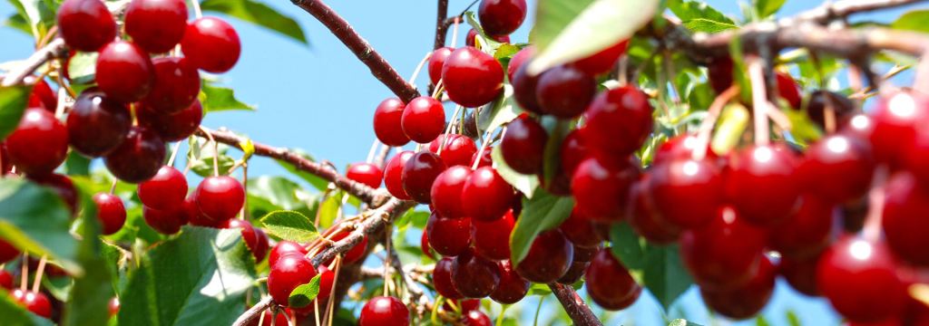
Wisconsin today is the fourth largest grower of cherries in the country (behind MI, NY, and UT), which is good for 10% of all cherries grown in the US… quick aside here, if I were in charge of the state, and I know I’m not, but if I were, I’d make sure we get close to number one. There is zero reason we shouldn’t be, and frankly, being behind Michigan in something is embarrassing. I mean, we’re number one in cranberries, and I think we need to add cherries to that. But besides the cherries, there’s one more thing Sturgeon Bay is known for, and that’s the maritime industry. While the cherries are not exclusive to Sturgeon Bay (it’s a total Door County thing), the maritime industry is a lot more Sturgeon Bay focused (in the modern day).

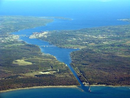
If we’re being frank (and why wouldn’t we [also… any English majors… should I be capitalizing ‘frank’? it’s a name, but I’m not using it in the name sense. I’ve always wondered this]), I could write an entire post on the history of the maritime industry in Sturgeon Bay, but don’t worry, I won’t (at least in this post ;). But when the fishing and logging and quarrying all declined, the maritime industry took hold. The 1800’s saw the building of the canal, and for good reason. Without the canal, a trip from the port of Green Bay to the body of Lake Michigan added an extra 100 miles. We all know time is money, so that is definitely a reason for the canal, but not the ONLY reason for it. Porte de Mortes (the door of death, Death’s Door, etc.) is a ship graveyard, found between the northern tip of the peninsula, between Gills Rock/Northport and Plum Island. The narrow strait of water, combined with shallow shoals, unpredictable weather patterns, and less-than-maneuverable sailing vessels at the time all combine to give this passage it’s eerie yet accurate name. While ghost stories on the northeast coast of this country might incorporate elements of sailors lost to treacherous passages and ships wrecked during sudden storms, the northeast part of our state has its own history to rival. All told, Death’s Door and the surrounding and nearby waters have claimed the hulls of over 64 vessels, and taken numerous lives as well.

The building of the canal in 1881 has no doubt saved countless lives from the icy grip of the waters of Porte de Mortes, as well as filled the wallets of those involved in the shipping industry with its massive time-saving route (and for a while the canal was privately owned too, no doubt proving profitable for those few years). The location for the canal was perfectly chosen, as the distance between the bay (Sturgeon, not Green) and the Lake (Michigan) is at it’s narrowest point here, while being closest to Green Bay. The peninsula does get narrower as you continue on, but then you’re also getting farther away from Green Bay, defeating the purpose of the canal. However, the thinking involved with choosing this location wasn’t as ingenious as you might imagine. The Native Americans had a well-trodden portage path from the bay to the lake in this exact spot, making the choice of location that much easier. For those unaware, portaging is the act of carrying your canoe from body of water to body of water. Since the path was laid, and the distance (relatively) short, Sturgeon Bay was chosen for the canal.


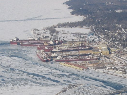
Sturgeon Bay as a shortcut to Lake Michigan isn’t where the maritime story for the area stops though. Sturgeon Bay has excelled in ship making as well. The deep waters of the bay, the ideal location to both the the port in GB and Lake Michigan, and the already established maritime history in the area all played a role in establishing Sturgeon Bay as a prominent ship building landmark. It peaked during WW2 ship production, but still continues to this day in both building and repairing ships.
Lastly, we obviously need to mention the newest industry to the area, and that’s tourism. And the point of my blog. Sturgeon Bay is just as picturesque a city to visit as Egg Harbor or Sister Bay, with more things to do than those other towns as well. Now, I’m not trying to discredit the other towns in the peninsula, but people passing over Sturgeon Bay for the other towns is kind of crazy. The crazy amount of things to do in this city, all there is to look at, all the opportunities for fun and adventure… now add in the history of this place? You need to make it a priority to spend a weekend here at the very least. You owe to yourself and to this state.

Leave a comment